One of the major assignments in PHOT2338 is architectural photography. There are several components, however one of the key parts is to capture a compelling image of a building exterior.
Even with all the technological advancement in the photographic industry of the past decade, if a photographer does not understand the qualities of light, they will always have a weak image. When creating images outdoors, we need to be aware of the position of the sun to best illustrate shape and texture. Of course this changes throughout the day and also at different times of the year.
For Fall 2011, I will be making use of the “Sunseeker” app that is available for iOS. Students will scout a building to photograph. While on location, an iPad loaded with Sunseeker will allow them to determine the precise angle of the sun on any date and time. At this point, they can collect this information as presented by the app using the built-in compass and GPS. (Part 1 of the assignment)
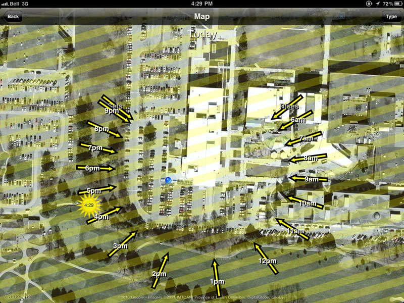 The blue dot (center left) shows my location at the SW corner of the Langara Library. Arrows illustrate the angle of the sun at various times of that day. The sun icon with “4:29” shows the position of the sun at the time when this data was collected.
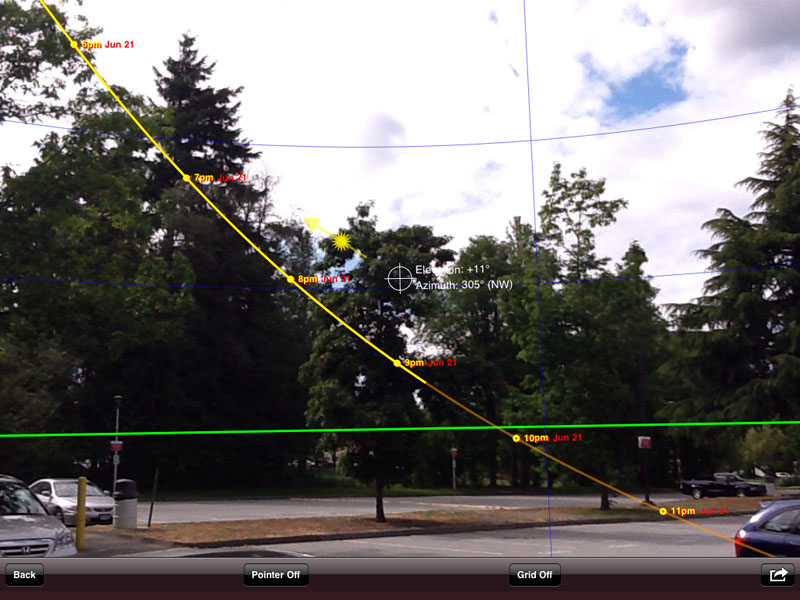
The next screenshot shows the path of the sun overlaid on an image captured using the built-in camera on the iPad 2. Instead of looking at the building to be photographed, the iPad 2 is pointed at the sky to determine the position of the sun. If, in this example, the optimum time was determined to be 7pm on June 21, the path of the sun is shown being hidden behind a tree. This obviously will not work for the final photograph.
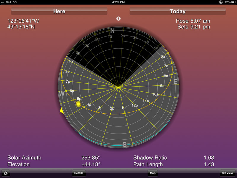
Part 2: Based upon the data that is collected, the students will analyze it to determine the best time of day to photograph the building based upon their camera angle and the orientation of the building. Screenshots from Sunseeker and scouting images will be posted along with their analysis to a Courseweb blog. The accompanying screenshots from Sunseeker illustrate the information that was provided while I stood at the SW corner of the Langara Library. There is also a compass view that shows solar path, orientation, sunrise and sunset times.
Part 3: The blog posts form a discussion point for class participation. The information can be analyzed by the class and they have the opportunity to help their fellow students find the best photographic solution (camera location, building/subject choice, lighting/time of day). The final step is to photograph the building with the objective of producing a 16×20” print.